
Gravel Bikes are a gift and there’s very few ways of expressing it more than Biking Pacifico Mountain.
The San Gabriel Mountains provides the experience of having the Sierras in our backyard, but some spots are more special than others.
My friend Bryan who is one of the most knowledgeable people of rides off the I-95 (and beer) recently ditched his road bike and went all in on gravel.
It had been quite some time since we’ve ridden together and I thought there was no better way of getting the juices flowing than revisiting this ride.

Pacifico Mountain Loop – 38.6 Miles, 4,883 feet of climbing
Once again, Vic joined who took part on my last outing, as well as Other Zack who also held the distinction of being the only non-Niner RLT member of our crew.
We met at the Monte Cristo Fire Station near the intersection of Angeles Forest Highway and Upper Tujunga Canyon Road.
Normally, the firefighters let you use the bathroom, but today the station was entirely vacant (more on that later).
The first part of our ride was riding six miles north on Angeles Forest Highway.
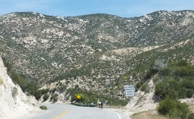
Tacking off the first six miles on Angeles Forest Highway
It’s a steady climb with not a lot of traffic as long as you avoid the late afternoon rush hour.
You’re wedged in between the mountains and your next destination of Mill Creek Summit comes in and out of view as you slowly approach.
At the juncture, you can either continue onto Acton, head west towards My Gleason and other misadventures, or ride up by the fire station to the entrance towards Pacifico Mountain.
Before the climb, it’s smart to refill your bottles, check the sign in log and empty the tank if need be.

Let the climbing begin!
I was asked to lead the way since I’m Mr. Familiar, but the gate to the dirt road is just off the parking lot diminishing that adventure.
Just past the start, there’s a sign for Jackrabbit Trail, which lo and behold had a jackrabbit running towards it, but the correct route is to stay to the left as there’s about three more miles of climbing.
The road itself was a little sandier than I expected after all the rains this past year and a shower a couple days before, but not problematic.

Other Zack with Mount Gleason in the background
Looking where you’re headed on this climb doesn’t yield as much as taking a glimpse behind you with Mount Gleason becoming more apparent and recognizing the switchbacks as artful folds in the landscape.
The pace was nimble enough to make good time, but also offered a chance to still chat.
Everyone nowadays claims to be an expert in craft beer, but Bryan is a real savant and hearing about the depths he goes to find selections countrywide has to carry a level of obsessive behavior.

I could never pull off keeping white clean on a day like this…
As we were getting up there, other Zack lagged a little behind which was way understandable after finishing the Belgian Waffle Ride way faster than an effort I would be willing to put forth.
The first magical moment of this ride is finishing this climb and taking in a view from the other side of this ridge.
Perhaps the valleys presented in front of you don’t have names, but more compelling is the overwhelming of solitude.
The only human presence is the occasional antenna perched miles and miles away.

Probably more like a suggestion…
This is the type of quiet that feels like a constant exhale.
Your eyes are drawn to this view on your right for the next couple of miles as the road widens with rollers.
When we got to the turnoff to Pacifico Mountain, we were faced with a couple of unusual circumstances.

Climbing Pacifico is a little tough, but smiley
The first being the closed road sign where we would continue on to after our out and bak to the peak, but the second issue (probably tied to the first) was the fire up ahead.
It was getting a bit smokey at this time, but not as much to affect our next climb.
My guess was the fire was five miles away, so the odds of it spreading and trapping us up on Pacifico in the next hour seemed unlikely.

#NinerParty
The ride up is only a mile and a half averaging 8%, but is a bit tougher than the earlier climb due to sand and upkeep.
Never have I seen the campground open at the top and at this rate I’m not expecting it.
There was also a big first on this ride: other people!

Break time
A group was hiking down from the top which little did we know would help us out later.
Reaching the top always provides for a moment’s rest not just from the grind, but for the view.
Mount Baldy, the Sierras and even Santa Monica Mountains all come into view as you ignore the chill of stopping at 7,000 feet.

Other Zack with his other bike
I’m not a camper, but if the grounds here would even reopen, it might be a step in helping me reconsider.
A few photos aside, we made our way back down on my trickiest descent on Pacifico with a number of downed branches to navigate.
Since I was being cautious on the way down, I hoped the others had decided what to do about the “road closed” sign by the time I had gotten there.
The fire was still going, but the smoke wasn’t as bad, so we decided to push on since having to reverse wouldn’t throw us off at this point.
On the descent, we passed the group of hikers again who parked at Adler Saddle meaning the “Road Closed” signs weren’t much of a concern anymore.
The fire department was doing a controlled burn which explains why no one was at the station when we parked.
Reaching Adler Saddle, we were back on paved road, but heading directly towards the fire!

Where there’s smoke…
There’s two choices to make it back to the Angeles Crest Highway and as we approached this intersection, the shorter and dirtier option we were hoping for was open.
It’s about three miles of downhill, but the fun of it makes you feel like you’re getting extended time there.
You have to be aware enough to catch the little ruts caused from the rain, but even then, you won’t be penalized too much if you’re just taking in the view.

What a way to wind down
Coming into Chilao Campground, I don’t know how I missed this before or if it was new, but right after we hit the asphalt appeared a magical water fountain just in time for a refill.
Riding between the tall pines doesn’t make you feel like you’re just an hour drive from DTLA, but you realize you’re starting to make it back once you hit the highway.
I tried convincing the group to do the Mount Mooney shortcut, but more dirt climbing seemed out of the question although I think they regretted the decision once they saw where it came out.

Gravel bikes let the big smiles hold on pavement too
The big descents soon showed the versatility of a gravel bike as we sped down without much of a difference as if we were rolling on 25s.
We were drafting off of each other with enough efficiency that other Zack didn’t notice Bryan passing spitting a nice loogie into his face.
The last nine miles is mostly downhill on Big Upper Tujunga which on top of solitude, sets a standard for how all roads should be paved.

Time for some tucking
Returning to our cars, I knew without out asking this ride fulfilled all of it’s promises.
And then some.
Biking is a gift, but gravel rides can feel like the best birthday present ever!
If you can’t get enough gravel, join our Gravel Bike California Facebook group.