On my quest to bring you all things Valley, witty commentary and the occasional bike path, today’s installment takes me out to _______ to cover the ________ bike path.
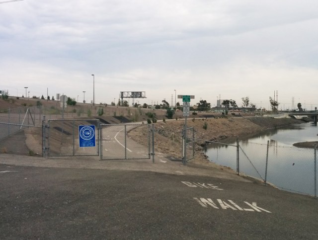
 No, those weren’t just generic placeholders, I kind of forgot about this journey. Last month, I had to return to my dentist(again) and used the opportunity to diverge a bit by taking a slight detour through Gardena and then taking the Dominguez Channel Bike Path towards Carson.
I’ve driven on Artesia Blvd. before, but when you bike on any road with speed limits posted at 45 mph, you feel a bit uneasy. Coming from the west, getting onto the bike path is a bit tricky staying away from all the cars merging onto the Harbor Freeway of the 91.
Once you’ve passed the first level of Frogger to get across, Google maps shows a path on both sides of the channel, but the east bank seemed to be the only side open which was fine because it’s the longer of the two.
Initially, the first thing you notice is that the Dominguez Channel has a lot of water! We’re in the middle of a drought, but this little tributary looked pretty robust. Maybe I need a hydrologist on staff.
Heading down the bike path, you notice about halfway a large homeless encampment straddling the west bank. There’s a

small one on the east side tucked underneath an overpass, but I chose wisely.
The path itself is pretty bland to talk about. The surface is in great shape, just short of being immaculate. You’re shielded
from the environment without being able to view your surroundings. While the channel is full of water itself, there’s no wildlife or vegetation to really speak of. I saw only one other cyclist on the path the whole time I was out there. Was he lost? Probable.
Overall, it’s just a simple 1.4 mile path that takes you from point A to point B. Point B does look a bit intriguing seeing the Goodyear Blimp airfield as you hit the southern terminus at Main St..
The problem you face here is crossing the street with no viable options that address your existence. The diagonal nature of this bike path would suggest that cyclists would want to continue east, as in my case for reaching the Carson Sports Center.
How am I supposed to cross this?
That requires crossing a road with no signals or markings and a median to negotiate. You’re also faced with a street with no sidewalks to the east and substandard ones to the west. There are no markings there, so you’re on your own to find a proper solution.
Once again, we have another path that was constructed as an afterthought in an area that is particularly void of bike infrastructure. If you make it out for any reason, please share it, because I am coming up blank to find any purpose to return.
Northern Entrance
The only building you see out in the distance…
Clean transition under some street…
Some signs of light under a bridge that I didn’t stop to take a better picture of.
Who doesn’t want to jet ski through this?
UFO


