
Old Ridge Route Loop: 66.3 miles, ~ 69o0 ft. climbing
Finding rides of epicness normally requires some good traveling, otherwise you probably shouldn’t use the word epic as much.
Finishing off my winter break, I wanted to get in one more ride of note and I was feeling choosy.
I deserve this.
The Old Ridge Route has always been on my radar even before I got heavily into bikes because of it’s history as an early passage road between Los Angeles and Bakersfield a hundred years ago.
I always love finding early California history and considering I spent New Year’s watching Heull Howser episodes, this road intrigued me very much.
Road Trip with Huell Howser – Ridge Route
In it’s heyday, the road featured many nitchy stops every few miles to attract business similar to Route 66.
Unfortunately, this windy route took drivers twelve hours to complete and when the separate Ridge Alternate Highway was built into the Ridge Route’s teen years, all the aligning businesses disappeared too.
A few years ago, a famous race car driver found the town and revived the route to its previous glory using his fame and fortune to attract travelers off of the main highway.
Or maybe I’m thinking about the plot line to the first Cars movie.
In reality, there are only scant remnants left and most of the road is closed off to automotive traffic meaning hello bike adventure.
My friend Vic and I were both ORRRs (Old Ridge Route Rookies) and while I’ve heard people cover the route on road bikes with 25s, we figured gravel bikes were the best choice since we’re pretty sure no one has taken care of that road.
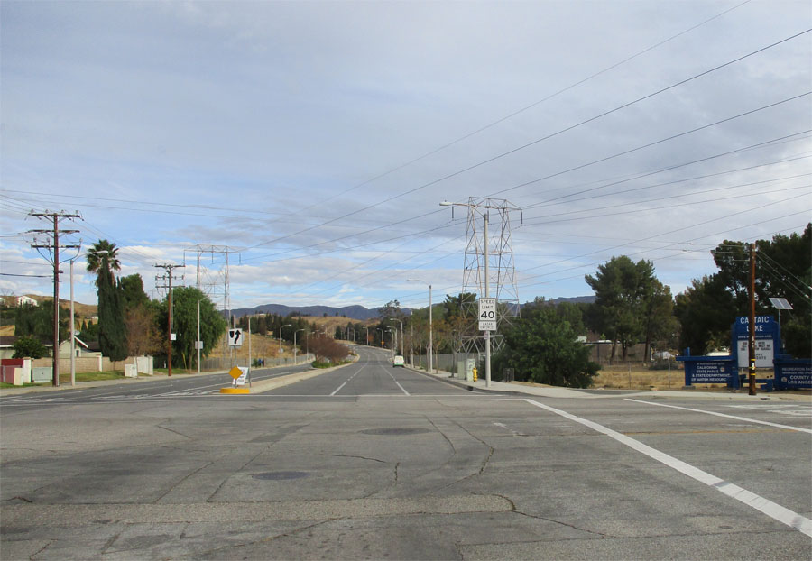
We started out in Castaic which lacked a lot of old world charm, but plenty of fast food options if that’s your fancy.
Just a warning before you go: there’s no water along the route and the closest place to refuel is in Lake Hughes.

The most lackluster part is the start.
Off the bat, you get a lot of elevation as you climb soulless tracts of upscale housing where kids can’t play in the street or they’ll get warped by the
slantiness.
After about a mile of this, you pass a concealed elementary school, the road narrows to one lane in each direction as you say goodbye to modern offerings.
You start to see the range of mountains and Castaic Lake below, but as you pass the hill to your left your introduction to your time capsule adventure begins.

A lot of mountain viewage ahead.
From the ridge, you have a prime viewing spot of I-5 and instantly you understand the efficiency and scale that modern engineering provides vehicles.
You feel like a fly hanging out in the rafters with no one noticing you as the world just passes you by.
There’s an occasional home and the steepness lets up a bit, but how you perceive speed and space feels different in this stretch.

“Progress”
As the road shifts to providing mainly easternly views, you hit a short downhill to your last crossing as you pass Templin Highway.
This road leads down to the northwestern edge of Castaic Lake and can handle higher vehicular speed, but to our eyes, this road felt just as vacant as the one we were riding.
After a short climb, we came across the biggest cluster of longtime homes along the old road right before we hit the gate closing off the route to vehicular traffic.

Last stretch of “open” road until we hit the gates.
To this point, the road surface had been in pretty good shape and even as we passed the “End of County Maintained Road” sign, things were looking pretty good.
Surprisingly, the road got better as the asphalt transitioned into a smooth concrete which I’ve rarely seen anywhere in Los Angeles.
At the end of this section, we met Trey, who’s a Santa Clarita veteran and we swapped war stories before we went our opposite ways.

Ridge Route veteran Trey.
He also holds the distinction of being the only person we saw along the closed portion of the Ridge Route.
Soon after we got back onto asphalt, there was a set of cones laid down one of the rare centerlines we saw on this ride.
Why you would have to divide traffic on a closed road is a mystery to me, but to the side was the first of many markers along the way.

Divided traffic on a closed road?
They were spaced out roughly every two to five miles and while the wording and artwork had faded out long ago, we knew they were historical markers of some form.
The first appeared to have been the site of a gas station as we tried squinting at the placard’s remains, but along the way, we noticed these markers were accompanied by a more recently placed stake off to the side that simply lists the location’s name.
Many times, rusted out artifacts were placed around them providing you with the best clues on what life was like back in the day.

Markings….
Even without much to see, we spent a good amount of time at each stop imagining what it would of looked like a hundred years ago and how difficult it would have been to travel.
From here, the road gradually degraded from cracks to potholes to large swaths of dirt.
While this is not supposed to be a maintained road, we saw a proliferation of these 3′ x 3′ rubber mats that we could only assume were meant to make the road a little more passable for those maintaining the parallel power lines.

Mats! Mats! Mats! Mats! Mats! Mats! Mats! Mats! Mats!
The road continued to gradually climb with the occasional downhill as we followed the ridge.
Vic and I discussed how this road could have been mapped out with century old technology.
We never hit a pitch that steep as the road swade in a serpentine fashion through the hillside and it made us wonder if there was much surveying done at all.

Ridge Route keeps surprising.
Just then, we rode into an unusual rock formation.
After riding through, we a sign signifying this as Swedes Cut.
This was a significant piece of engineering that cut away 110 feet deep of rock for this small passageway.

How Swedes Cut it is!
Another construction detail I didn’t comprehend right away was how some of the road was an updated version of the original.
I started to notice how the land was cut in certain areas making the route straighter (with the help of more modern technology), while the original concrete lingered to the side making a larger curve.
As we approached the northern gate, we came across the most significant remnant of the ride.
It was impressive to see this well preserved archway that stood strong against earthquakes, fires and mother time.
This was a gateway for the Tumble Inn complex that included food, lodging and a garage.
Just like those solitary fast food joints in the middle of the Central Valley along I-5, you had to imagine employees had a far distance to reach work.

Tumblin’ into the Tumble Inn.
In this case, some of the workers probably had to live at these sites because driving daily would have been too time consuming and tenuous.
Having recently topped out at the high point (4,300 feet) the remainder of our portion of the ride was a rewarding downhill.
We passed our last historical site of the day stopping at Sandberg’s.
Even without little physical indication of what was there, I could feel by it’s layout that something significant used to exist here and looking back at old photos confirm it.

Old postcard of Sandberg’s.
While you can still ride the Old Ridge Route all the way to Fort Tejon, we reached our turn around point at Pine Canyon and we had a choice to make.
This ride, including all of our stopping, took 3 1/2 hours to cover.
Do we return over the 26 miles we just covered or ride 40 over modern roads?

Enjoying this windiness.
Although we were short on sunlight, we decided to take the loop and make sure we took less pictures this time.
Pine Canyon was a fun mix of blazing downhills and five minute climbs.
Over this eight mile road with no centerlines, we only encountered one motorcycle and one mailman allowing us to eyeball the theater that Antelope Valley served to the north.

Pine Canyon had an intrigue all of its own.
We merged with 3 Points Road with much heavier traffic, but with this being the start of a 17 mile downhill, the extra vehicles didn’t feel so worrisome.
Lake Hughes Road was our last turn towards our starting point and after we discussed getting water up the road, we decided to just go for it.
Going downhill seemed to never end, but after getting complacent, there was a two mile climb with a few more humps before we got back to our car.
I didn’t expect this to be one of the most interesting rides I’ve done and it’s one I’ll welcome to do slowly to take in the sites.
Ride the Old Ridge Route and you’ll be instantly interested in its history and there’s a good amount of literature as well as online resources.